I thought I would give some background information on the research Emily and I are working on. Today’s post will be the background, and my next post will explain the methods we are using in our research, hopefully breaking this into two parts will keep it from becoming too lengthy.
The Tall Grass Prairie Preserve is owned and ran by the Nature Conservancy and has over 100 oil producing wells scattered throughout the preserve. In January of 1999 a pipeline carrying oil broke and spilled about 70 barrels of crude oil over an area roughly 900 square meters down a slope from the pipeline. The area effected was contaminated with an average of 35,000 mg/kg of total petroleum hydrocarbons.
Bioremediation efforts began on the site in May of 1999 and were performed every three months until October of 2001. The entire area had prairie hay applied and was then tilled. The research area was then divided into three sections, the top of the slope closest to the pipeline break was left unfertilized while a second area further down the slope was fertilized and a third area nearby (tilled but not effected by the spill) was set aside as a control.
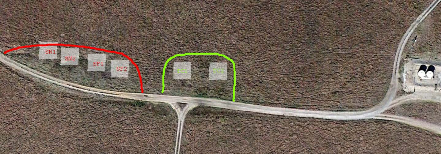
This picture shows an aerial view of the unfertilized (SN1 & SN2) and fertilized (SF1 & SF2) spill areas (red) and the tilled control (TC1 and TC2; green) area containing the six quadrats (white squares) sampled for vegetation.
In 2010, after several years of undisturbed revegitation, observations suggested that plant growth and community composition of the spill zone are still substantially different from the surrounding prairie. This observation led to the hypothesis that the plant species composition differences are associated with hydrocarbons that are persisting in the soil after the bioremediation process.